Guide to Rwenzori Mountains National Park
Contents of our guide
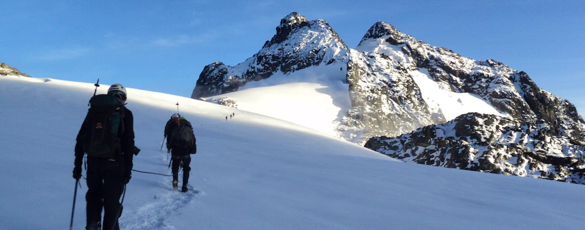
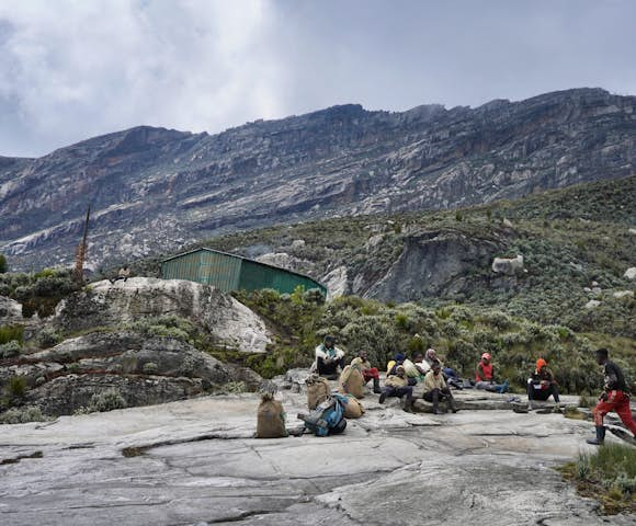
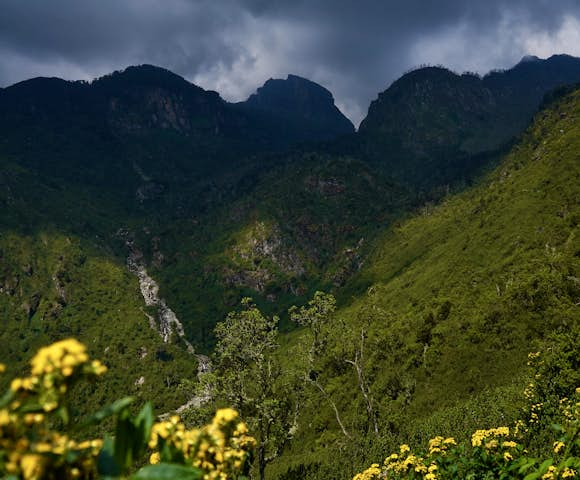
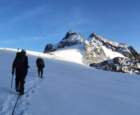
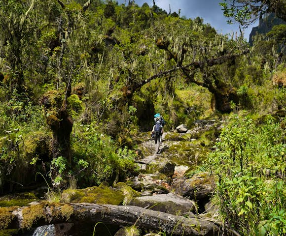
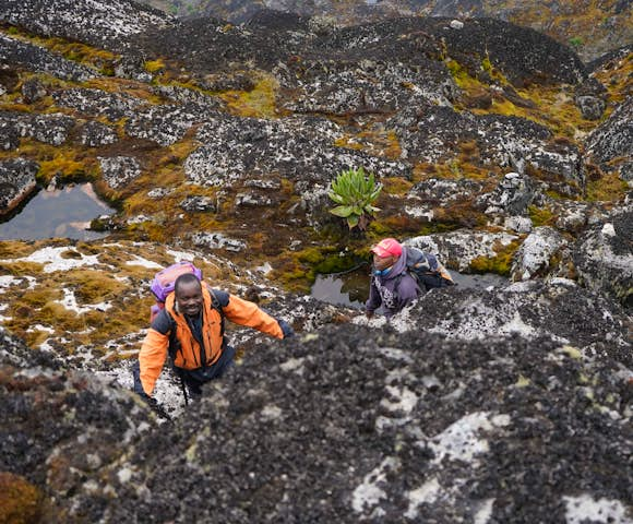
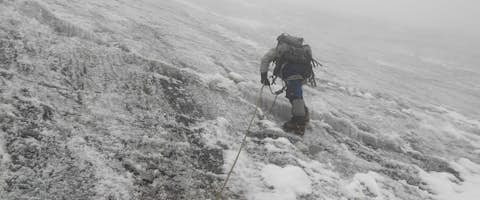
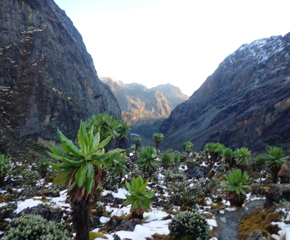
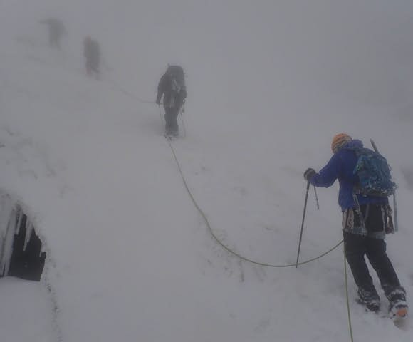
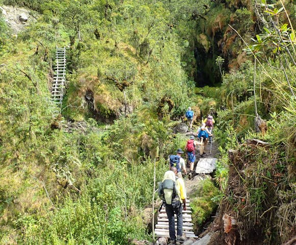
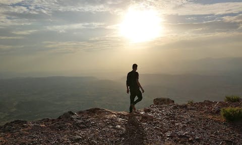
Above the clouds on the Ugandan border: last leg of summit hike
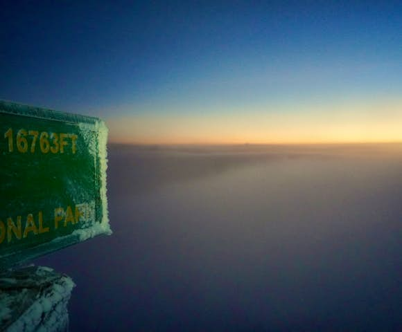
Hiking the snow-capped peaks of the Rwenzori Mountains.
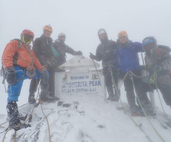
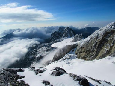
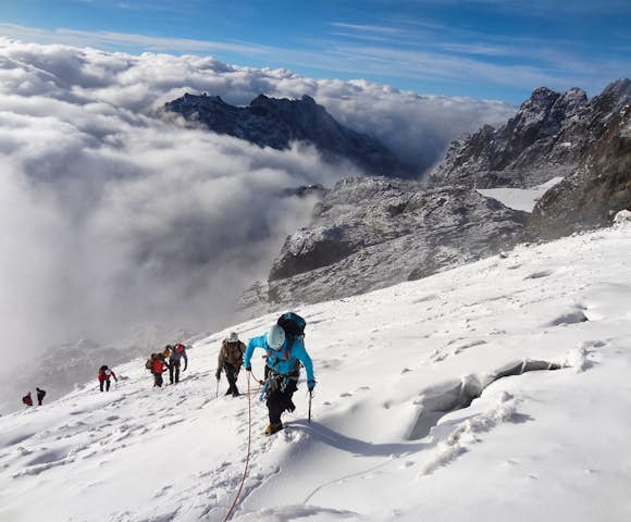
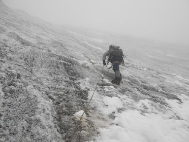
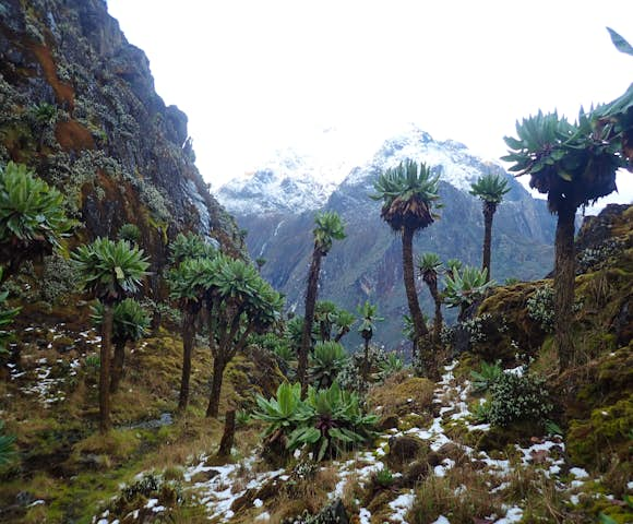
Reaching the summit, Margherita Peak

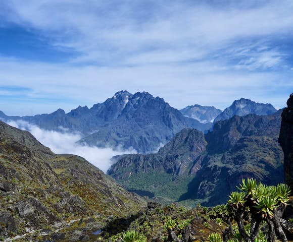

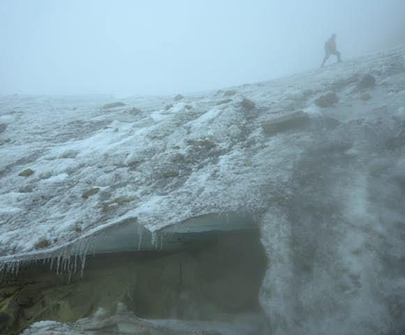
Summit push to Margherita peak.
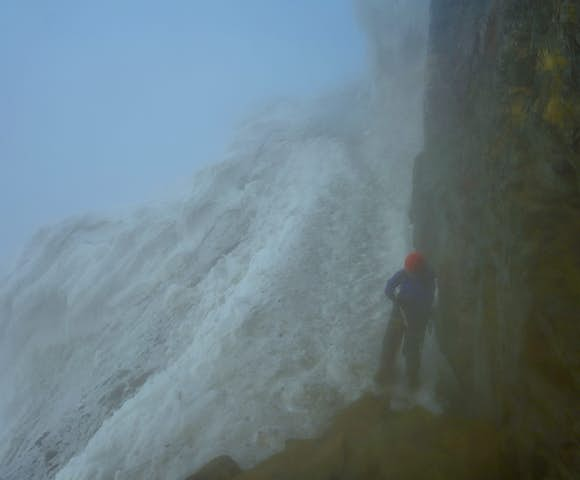
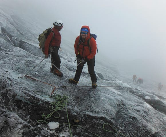
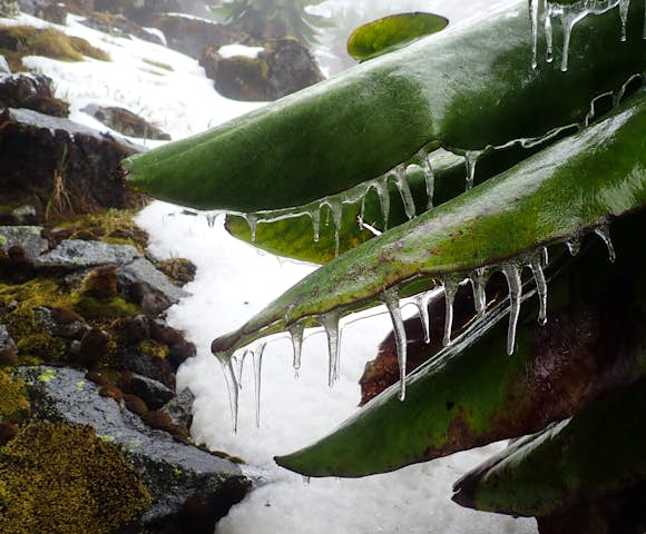
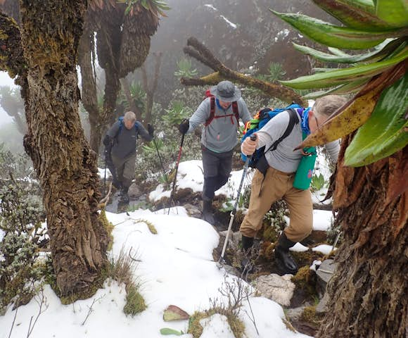
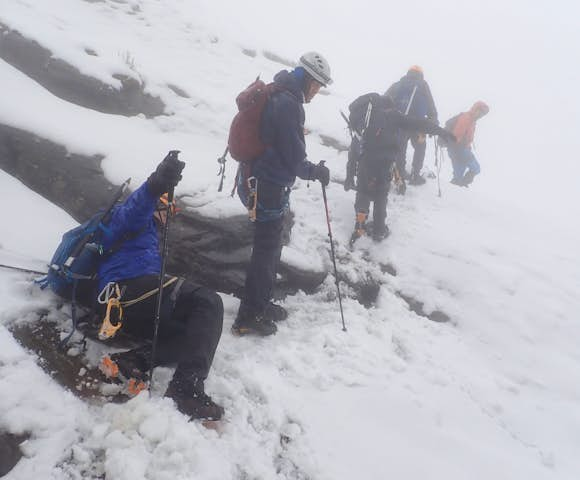
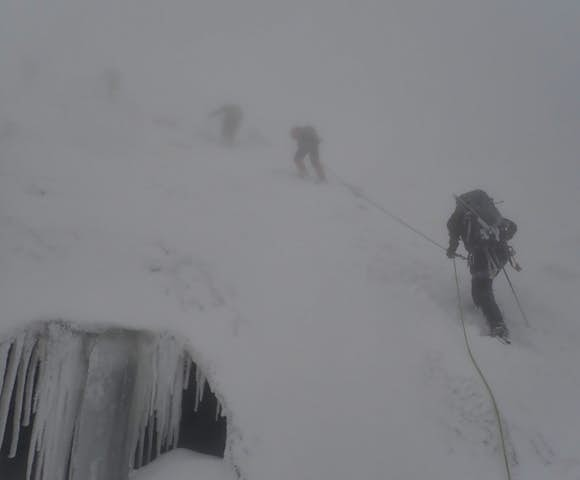
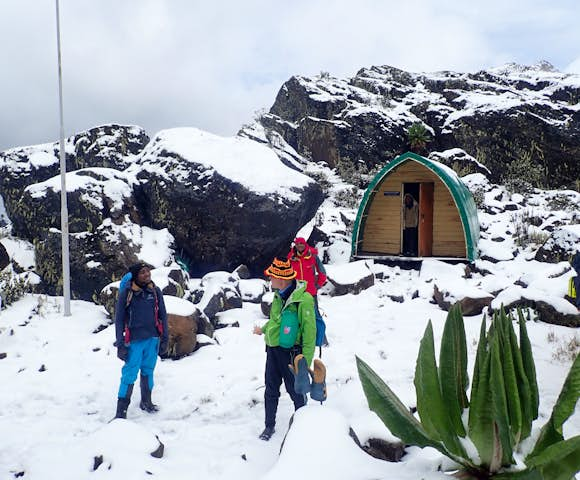
Floors covered in ice and steep gradients form part of the Rwenzori trail.
Trekking in the Rwenzori Mountains, at a glance
- There are two types of hiking experiences in the Rwenzoris: high altitude and low altitude. The low altitude treks won't take you beyond 4,000 metres and typically last 2-4 days. High altitude treks take you to the peaks above 4,000 metres, and last between 4-12 days.
- The Rwenzoris can be visited as a standalone adventure, but they're often combined with other destinations along Uganda's south-west circuit, including Kibale National Park, Queens, and Bwindi Impenetrable National Park.
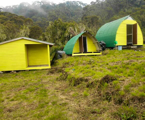
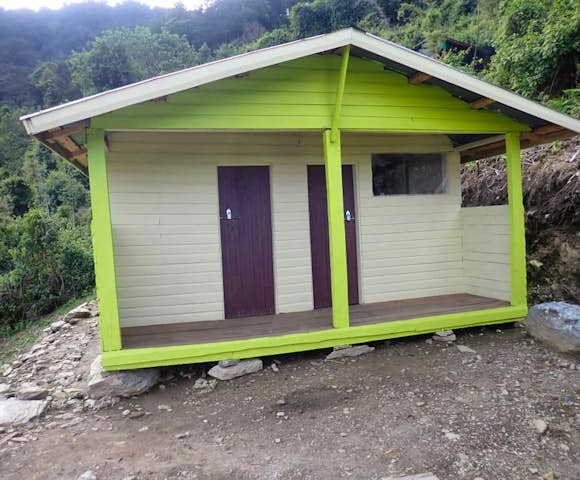
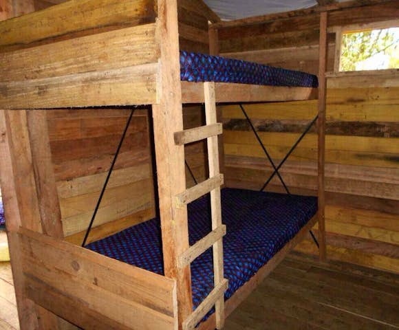
- Accommodation is in basic wooden huts that have been constructed along the trails, each fitted with bunk beds and a separate toilet huts.
- The Rwenzoris are home to Uganda's highest point: Margherita Peak (5,109m) on Mount Stanley. If you want to summit Margherita Peak, you will need to spend a minimum of 7 days in the mountains.
Popular Treks in the Rwenzori Mountains
These trips can be booked directly, adjusted to suit you, or we can start with a blank sheet of paper and build a completely tailor-made itinerary.


Introduction to the Rwenzori Mountains
A magical land of fantastical vegetation and snow-capped peaks
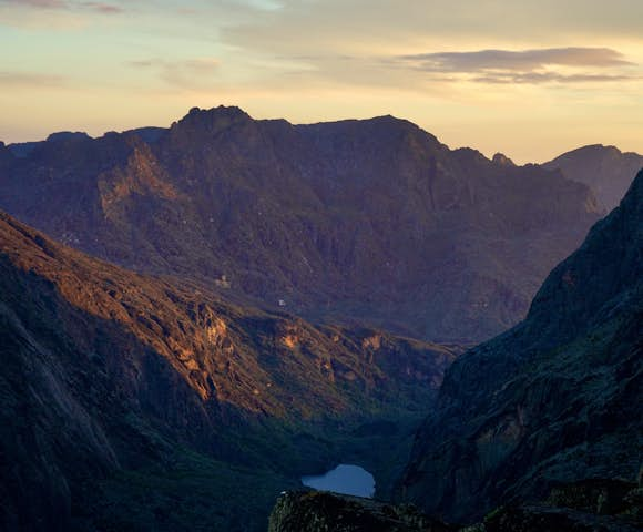
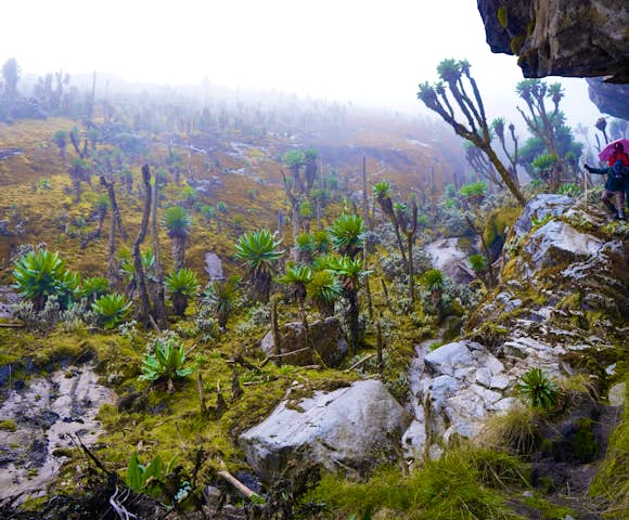
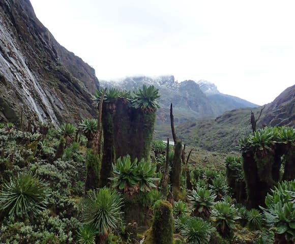
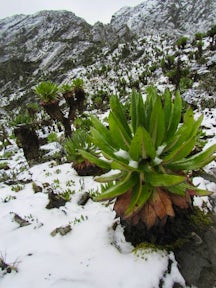
The Rwenzori Mountains are one of the most exciting and challenging mountain ranges to trek in the world. 996 square kilometres of fantastical vegetation, lakes, rocky outcrops, cliffs, high glaciers and snow-capped peaks exist as a unique and mystical world into which you can escape.
The height of the peaks may not match taller mountains elsewhere in the world, the highest point - Mount Stanley’s Margherita Peak - is 5,109 metres (although this is still the 4th highest peak in Africa!). But their remote location, fluctuating weather conditions, startlingly diverse vegetation, remoteness, viewpoints and low visitor numbers combine to thrill adventurous trekkers looking for a very special experience.
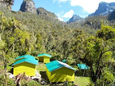
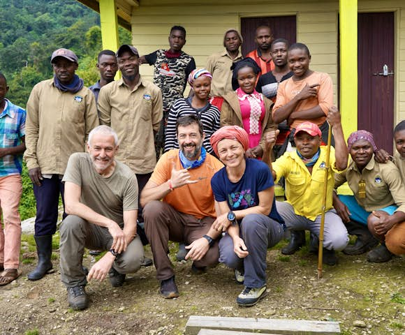
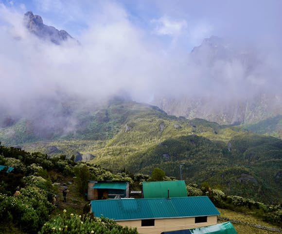
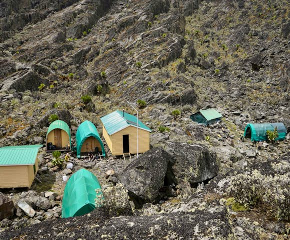
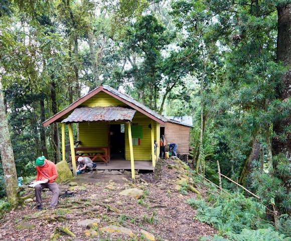
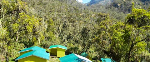
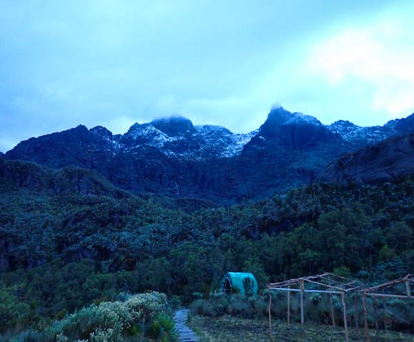
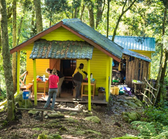
Kiharo camp in the Rwenzori foothills.
A snapshot of the mountains
The Rwenzori Mountains were gazetted as a national park in 1991, recognised as a World Heritage Site in 1994 and a Ramsar site in 2008. These classifications testify to the mountains’ international scientific importance. The word ‘Rwenzori’ roughly translates as ‘Rainmaker’, which clearly illustrates the importance of the mountains to Central Africa.
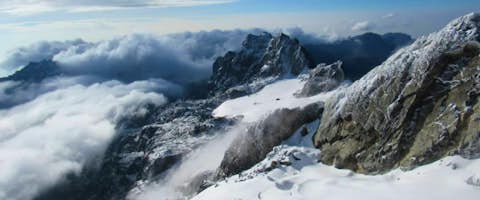
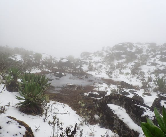
The atmosphere is wet; the mountains receive over 3 metres of rainfall a year. This makes the lower slopes lush with vegetation and the higher reaches covered in snow and ice. Although the glaciers have retreated massively over the last hundred years due to climate change, climbers in the wet season months will still have to navigate ice walls and significant snowfall to reach the peaks.
Alpine adventuring meets Central Africa.

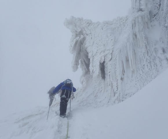
Eyes on the prize; heading to the summit.

Brilliant says
The Rwenzoris were referred to as the ‘mountains of the moon’ by Claudius Ptolemy, the famous Greco-Roman mathematician, astronomer and geographer. Gazing out at night at the permanent glaciers aglow with reflected starlight, it is not hard to see why.
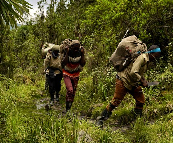
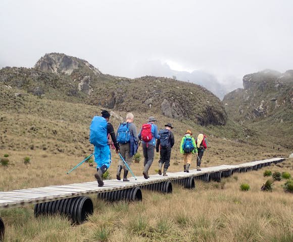
Trekking in the Rwenzori Mountains
The Rwenzoris must be explored on foot, and you must be of above average fitness and used to endurance activities. Margherita Peak has recently been reclassified as a technical climb and although you don’t need to be an expert climber in winter conditions, some experience is recommended.
A good variety of treks, from one to twelve days, are available to suit different interests from ‘peak baggers’ to birders keen to trace the region’s endemic species.
Routes can also be extended where necessary for private groups to provide more opportunity to acclimatise to the altitude or to simply enjoy the peace, seclusion and beauty of the mountains.

The Rwenzori treks are tough, but you can't beat the views.
The trekking routes
Two trekking circuits provide access to the Rwenzori's peaks: the Central Circuit out of Nyakalengija and the Southern Circuit out of Kilembe. While the Southern Circuit was the route first followed (largely) by Professor Scott Elliott in 1895, it is the central circuit, pioneered by Luigi di Savoia in 1906, that for many years provided the only access to the mountains.
At Brilliant, we only organise treks for the Southern Circuit. This is because it provides the most intense and impressive experience of almost unbelievable landscapes. The southern circuit also has some longer routes that benefit acclimatisation (and the overall experience).
Traversing the ice and snow where central and eastern Africa meet.
Which trek is right for me?
Unlike other popular trekking destinations in Africa, the Rwenzoris are a mountain range, which means there are a number of different routes to choose from.
One of the benefits of trekking in the Rwenzoris is that the routes are typically longer than many other high altitude treks like Kilimanjaro - this means you have longer to acclimatise and the risk of altitude sickness is reduced.
Treks range from 2-12 days. Below are a few examples of how the Rwenzoris can feature in your Ugandan adventure. These trips can be booked directly, or adjusted to suit you.

Reaching the summit, Margherita Peak
I'm looking for...
-
A short trek to add-on to my safari
The Rwenzori Mountains work perfectly with a safari circuit in Uganda. The Rwenzoris are about 50 kilometers from Queen Elizabeth National Park and Kibale Forest National Park, and the gateway city of Kasese is easily accessible from Entebbe, Kampala, or if you're coming south down from Murchison Falls National Park.
If you're looking for a 2-5 day trek to add in to your safari itinerary, there are plenty of options in the Rwenzori Mountains. Below are a few itineraries that work well, but everything can be adjusted to suit your interests, fitness, and wider travel plans.
- The Rwenzoris at a glance (2 days, max altitude 2,596 metres)
- 3 Days in the Rwenzori Mountains (3 days, max altitude 3,174 metres)
- Hike to the Mutinda Lookout (4 days, max altitude 3,975 metres)
- Waterfalls of the Rwenzoris (4 days, max altitude 3,174 metres)
- Trek to Weismann's Peak (5 days, max altitude 4,620 metres)
-
A challenge
If you want to really stretch your legs, and have some experience hiking at high-altitude, then you can tackle some of the high-altitude routes in the Rwenzoris. These routes are among the best hiking experiences in the world (and we've done a lot of trekking!).
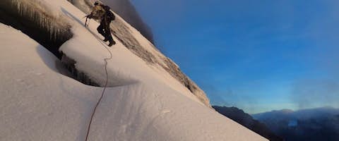
The crown jewel is Margherita Peak on Mount Stanley, this summit is Uganda's highest point at 5,109 metres. The Rwenzoris are one of just 3 places in Africa with permanent glaciers (the others being Mount Kenya and Mount Kilimanjaro), which means you'll be tackling ice and snow to reach the summit. The summit hike itself is technical and involves the use of crampons, ropes, and belays.
We have a 98% success rate in summit hikes to Margherita Peak. While some experience is always preferred, most of our clients haven't used crampons/ice axes before. Our local guides are absolute professionals, and if you're in good shape and determined, you should have no problem reaching the Rwenzori's icy peaks.
Here are a few popular high-altitude routes. Note that if you want to hit Margherita Peak, you'll need a minimum of 7 days in the mountains in order to properly acclimatise.
- The 4 Peaks (10 days, max altitude 5,109 metres)
- Climbing Margherita Peak (10 days, max altitude 5,109 metres)
- The Ultimate Rwenzori Trek (12 days, max altitude 5,109 metres)
- Hiking Mount Baker (7 days, max altitude 4,842 metres)
-
A standalone trek
While the Rwenzoris are often combined with other destinations in Uganda's south-west, many people choose to visit Uganda just to trek in the Rwenzoris. They are also a popular weekend trip outside of Kampala for locals and expats.
If your eyes are on the Rwenzoris, and you're not looking to include them as part of a wider itinerary, then you've got plenty of choice. The route you'll choose will depend on your time constraints, fitness, and interests. Get in touch with our team, and we'll help you find the itinerary that's right for you.
2-12 Day Treks in the Rwenzori Mountains
Brilliant says
We have a 98% success rate in summit hikes to Margherita Peak. While some experience is always preferred, most of our clients haven't used crampons/ice axes before. Our local guides are absolute professionals, and if you're in good shape and determined, you should have no problem reaching the Rwenzori's icy peaks.
Guides and sustainable tourism
All of our guides receive comprehensive general mountaineering and specific ice climbing training. They are trained in mountain first aid and so are able to spot and respond to the first signs of altitude sickness. Rescue procedures are practised and reviewed regularly. Equipment is well-maintained and frequently checked.
$5 from the cost of each climb goes towards local development projects, contributing over the years to the construction of community trails outside the national park, spreading the potential benefit of tourism, and constructing school classrooms in multiple locations.

At Mutinda Lookout at 3,975 metres
Brilliant says
We work with closely with the very best regional specialists. Whether you are focusing exclusively on the Rwenzoris, or including them as part of a wider itinerary across Uganda, our expert team can help put together the trip that matches your dreams, budget, and appetite for adventure.
Rwenzori Mountain FAQs
-
What is the difference between high and low altitude treks?
The 3 day and 4 day treks are classed as low altitude treks. The high altitude treks start with a 5 day trek to Weismann's peak. All the treks going to the technical summits of Margherita Peak (5,109m), Mount Baker (4,844m), and Mount Speke (4,890m) are high altitude treks.
High altitude treks require different equipment (see our kit list below), and different levels of experience and fitness.
-
How long is a typical day trekking?
A typical day hiking in the Rwenzori Mountains is 7 to 8 hours. You will typically cover 7km - 9.5km per day, depending on the distance between the camps.
The final push on high altitude summit hikes take significantly longer, with average treks lengths of 10-14 hours to reach the summit.
-
Are the treks technical? Do you need to bring any specialised equipment?
None of the low altitude hikes are technical, and you do not need any specialist equipment. Please refer to our kit list below.
For high altitude treks, the only technical climb takes place on the last day as you go for the summit. This typically takes place on day 6 of an 8 day hike to Margherita peak.
The technical section involves the use of crampons, ice axes, and other equipment but all of this equipment is provided for you.
-
How much experience is required?
We generally recommend that you have experience with at least one high-altitude hike before tackling any of the high-altitude routes in the Rwenzoris.
Most people with decent fitness and some experience hiking at altitude will be fine on the low altitude treks. The Rwenzori routes are long, which in itself enables you to acclimatise as you trek (slowly). In contrast, people can climb Kilimanjaro (5,895m) in 4.5 days, starting from just 1,000 metres, which puts them at a much greater risk of altitude sickness.
If you're planning to summit Margherita peak, you will need to have good fitness and ideally some experience with ice/technical climbing, including the use of ropes, crampons, belays etc. However, a lot of it comes down to mindset and determination, and while the hike is challenging, if you are in good shape and determined, you should be fine on the mountain.
Most of our clients haven't used crampons/ice axes in the past, yet our summit success rate is 98%.
If you have no climbing experience and would rather skip any technical climbs, another great option is to head to the Stanley viewpoint at 4,908 metres. From here, you're rewarded with fantastic views over Congo and the mountains ridges including Mount Speke, Mount Baker, and Margherita Peak.
Essentially, anything that gets you into the heart of the Rwenzoris is going to be an incredible experience because of the unique habitats and landscapes.
-
What safety precautions are taken? What training do the guides have?
The Rwenzori Mountains are on the Uganda - DRC border. UWA rangers patroll the mountains, and the border to DRC are heavily guarded by the UPDF.
The trekking guides have been trained by several international mountaineering instructors and are all very capable. The guides regular complete new courses that cover everything from guiding, customer care, nature interpretation, birding, product development, rock climbing and belaying and Wilderness First Aid.
All the guides have acquired first aid training and complete regular re-fresher courses.
The standard of both equipment and training is very high in the Rwenzoris. The team is also constantly in the mountains finding new routes and keeping existing ones open, so even when visitor numbers are low, they are not getting stale.
Importantly for us, the partners we work with in the Rwenzoris will turn business away rather than operate a trek if they consider it to be unsafe. They also have (successful) experience of mountain medevacs.
-
What equipment is provided? Is the equipment safe?
All of the technical gear is imported from the UK, including ropes, ice screws, ice axes, harnesses, and crampons. We do recommend every client comes along with their own pair of crampons, but there are also some to rent.
For all treks summiting Magherita peak, the following gear is provided: harnesses, caribinas, ice axes, helmets, rubber boots, ropes and ice screws.
You can hire sleeping bags, though they are not new. You could also carry sleeping liner to use inside the sleeping bag. Hiring one costs $15.
The team uses Black Diamond strap on crampons and finds that they do the job well.
-
Is their electricity in the camps?
There is solar power for light and charging phones/cameras at Sine Camp, Kalalama camp, Hunwick's camp, Kiharo camp and Margherita camp.
At Forest View Camp, there is solar for lighting but only outside. Solar lighting has not yet been installed inside at FVC.
The facilities at the camps are constantly improving as money from the treks is re-invested in the trekking infrastructure.
-
How is drinking water carried up the mountain?
All water is drawn from fresh water streams and purified. You should therefore bring water purifiers that can deal with at least 3 litres a day. We boil water at night for teas and coffee, and you can fill up your water bottle the night before with the same boiled water.
-
What are the meals like?
The meals are designed to keep you healthy, safe, and well-fed during the trek. The chefs can cater for all allergies.
Pro-tip: bring some of your favourite snacks with you, they're a great motivator during the trek!
Below is a list of foods served in the mountains:
Dinner
- Irish Potatoes, pumpkin, rice, meat, mixed vegetables, chicken, spaghetti, pasta, noodles, kraft cheese and Cheddar cheese, peas with mixed vegetables, beans with mixed vegetables, mushroom/onion/tomato soups
Breakfast:
- eggs, beef sausages, bacon, potato patties, bread, toast, milk, oat/millet/rice porridge, teas, coffee, hot chocolate, pancakes with syrup, baked beans on toast
Lunches:
- chicken salad sandwich, cheese and tomato sandwich, 300ml juice (apple and banana), tuna salad sandwich, potato salad, egg sandwich, chapati and jam, vegetables (tomatoes, onions, French beans, cabbage, eggplants, green pepper)
-
Are there mosquitoes?
There are no mosquitoes in the Rwenzori Mountains as the conditions are too cold. You should still carry insect repellent.
-
What is the accommodation like?
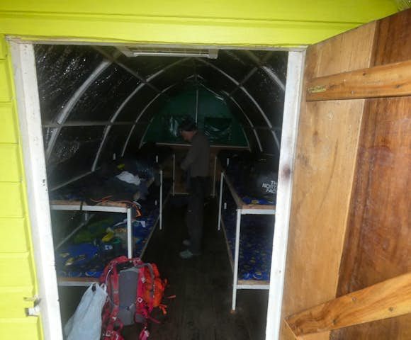
All accommodation during the trek is in huts with bunk beds (dormitory style) and mattresses. Twins or singles are not available as the huts are built to minimise their impact on the environment, which means efficiency over comfort! You will need to bring a good 4 seasons sleeping bag (see kit list below).
You can find more information about the huts here.
-
Do the treks run in groups, or on a private basis?
We run group treks and solo treks. You can book any date, and the number of other people in the group will simply depend on how many other travellers have booked to be in the mountains for those dates. If no one else has booked for your dates, the trek will run as a private tour.
Maximum group size for the high altitude treks is 8 or 9, or up to 15 for low altitude treks.
-
Is there a risk of altitude sickness?
If you are planning a high-altitude trek in the Rwenzoris (hitting one of the peaks above 4,000 metres), then altitude sickness is a possibility. One of the benefits of hiking in the Rwenzoris is that the routes allow you to spend longer in the park, giving you more time to acclimatise.
If you are tackling Margherita Peak, we recommend choosing an 8-day route or longer. While it is possible to summit Margherita Peak in 7 days, the risk of altitude sickness is higher, and it is no cheaper than an 8-day route.
Talk to our team if you have any questions or concerns about altitude sickness in the Rwenzoris.
-
Where are the Rwenzori Mountains?
The Rwenzori Mountains are in the south-west of Uganda, on the border with the DRC. The range covers a length of 71 miles along the border, and are one of the just 3 places in Africa with permanent glaciers (although these are melting at an alarming pace). The Rwenzori Mountains are just 50 kilometres from Kibale Forest National Park and Queen Elizabeth National Park.
-
Why are the Rwenzoris called the Mountains of the Moon?
The Rwenzoris have long been called the 'Mountains of the Moon', the moniker has been synonymous with the Rwenzoris for centuries. The name often appeared in the written works of geographers searching for the source of the Nile, and appears on maps dating back to at least the 1800s.
-
Are the Rwenzoris the highest mountain range in Uganda?
Yes, the Rwenzoris are the highest mountian range in Uganda. The highest point within the range is Margherita Peak at 5,109 metres on Mount Stanley. There are 3 other notable peaks in the Rwenzori range: Mount Baker (4,842m), Mount Speke (4,890m), and Weismann's Peak (4,620m).
Brilliant says
The Rwenzori mountains might just be one of Africa’s best-kept secrets. These mountains receive around 1,000 visitors per year, compared to around 50,000 for Mount Kilimanjaro, but are no less impressive.
Rwenzori Trekking Kit List (Low Altitude)
-
Clothing
- Light T-shirt/shorts for walking in the heat at the start of the trek
- Warm long-sleeved shirt for when it gets colder at night and for higher altitudes
- Good trekking trousers
- Fleece jacket and/or down jacket - any light jacket will work
- Light raincoat/plastic poncho and waterproof trousers
- Hat - a warm hat for the cold evenings and a sun hat to keep the sun at bay during the day
- Gloves
-
Footwear
- Hiking shoes - ideally you want good quality hiking boots, but good trainers can work for short low altitude treks
- Several pairs of warm, thick socks
- Rubber boot (for children) - we provide rubber boots for adults free of charge
-
Equipment
- Good quality sleeping bag (minimum rating 4 seasons)
- Soft bag/backpack - large enough to hold your personal gear on the mountain (this can be carried by a porter)
- Daysack - minimum capacity 8 kg. You will carry this, and needs to be big enough to carry your daily water (3 litres), lunch box, camera, wet weather clothing and jackets
- External protective cover for backpack and daysack (or pack all contents in plastic bags for waterproofing)
- Lip balm
- Torch or head torch with spare batteries (special batteries are not always available locally)
- Water bottle(s) to hold 3 litres - you will carry this with you daily
- Water treatment tablets/iodine or quality filter (all water is boiled by the staff for tea/coffee)
- Spare plastic bags (to keep things as dry as possible)
- Wash kit plus a small towel
- Basic First Aid Kit (for personal use) including paracetamol & dehydration sachets
- A few of your favourite sweets/dried fruit - something to top up the energy levels!
Rwenzori Mountains Kit List (High Altitude)
-
Clothing
- Summer shirts and shorts - for walking in the heat at the start of the trek
- Warm long-sleeved shirts – for when it gets cold
- Warm long walking trousers (not jeans!)
- Fleece jacket (one or more, and/or a down jacket) - for additional warmth; or a warm anorak/jacket (not too heavy!)
- Thermal underwear
- Good quality waterproof and windproof outer shell (jacket & trousers)
- Cheap plastic poncho or rain jacket & rain pants
- Hat – a warm hat and a sun hat (that has both a peak and shades the back of your neck)
- Wool hat
- Gloves - 2 pairs: one pair of thin liners and another warmer/waterproof set
-
Footwear
- Mountain boots - good quality and well worn in
- Walking shoes (another pair of lightweight walking shoes / trainers for the start of the climb)
- Several pairs of warm, cushioned socks (so you always have a dry pair to change into)
- Crampons for the summit day. It is essential you bring your own set of crampons.
-
Equipment
- Good quality sleeping bag (minimum rating of 4 seasons)
- Soft bag/hold all or ruckasck (framed or unframed) – large enough to hold your personal gear
- Day bag - big enough for you to carry your daily water (3 litres), lunch box, camera, wet weather, clothing and fleece jacket
- External protective cover for rucksack and day bag (or pack all contents in plastic bags for water-proofing)
- Sunglasses (models with side-shields are preferable)
- Lip salve
- Head torch and a set of spare batteries (special batteries are not always available locally)
- Back up torch and spare batteries
- Water bottle(s) (strong) to hold 3 litres
- Water treatment tablets /iodine or quality filter (although water gets boiled for you by our staff and served as tea or coffee which can also be filled up in your water bottles)
- Spare plastic bags (to keep things as dry as possible)
- Wash kit plus a small towel
- Basic First Aid kit (for personal use) including paracetamol and dehydration sachets
- A few of your favourite sweets - important motivators on the trek!
Brilliant says
We recommend you buy snacks in Kampala or Entebbe, or en route before you reach Kasese as there are limited options in the supermarkets in Kasese.
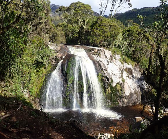
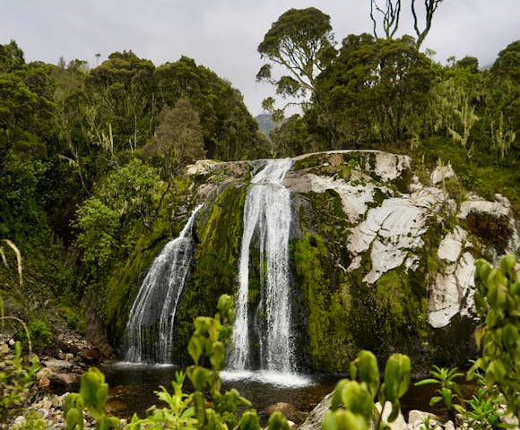
Beautiful waterfalls are found throughout the range
Crisp morning light, day 3 of the trek
Almost unimaginable beauty, Rwenzori Mountains
Rwenzoris are 1 of 3 places in Africa with glaciers
Reaching the summit, Margherita Peak
Higher and higher, into the clouds
Step by step, towards the summit
Base camp before the summit climb
Getting started, day 4 of the trek
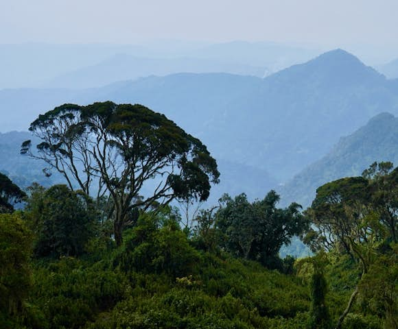
Lowland forests soon turn to snow-capped peaks
Watching our step, day 2 of the trek
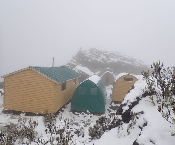
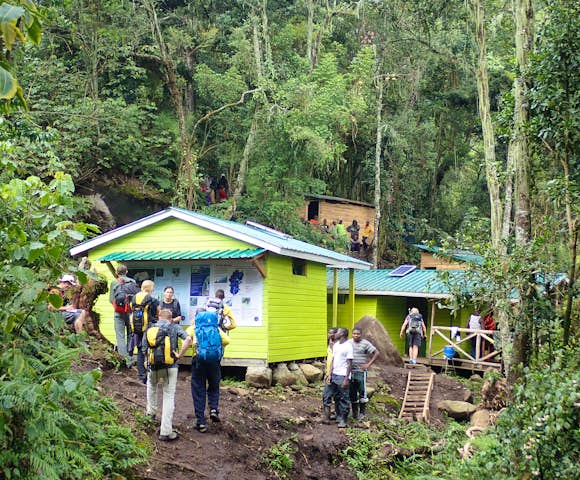
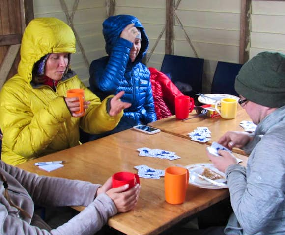
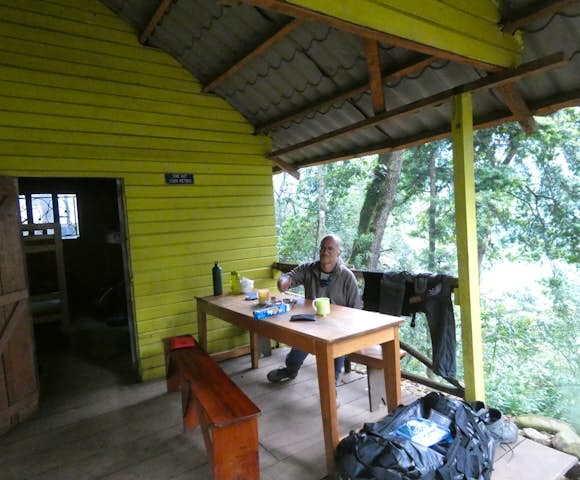
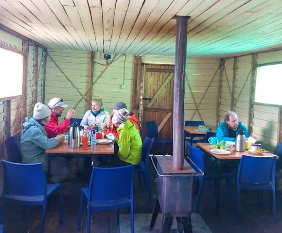
Accommodation in the Rwenzoris
The Kilembe Southern Circuit is accessed from the Kasese area. The best place to begin and end a trek is the Rwenzori Trekkers Hostel in Kyanjuki Village, 12km from Kasese. A well renovated former copper mine building, the hostel overlooks the deep Nyamwamba river valley and has amazing views of the Rwenzori Mountains. Situated at 1,450 metre, it also has a lovely climate even in the January and February.
Another popular option before the trek is to stay at Sandton Hotel in Kasese, and then transfer to Kilembe the following morning (departing Kasese ~7:30am, arriving around 8:00am). Upon arrival, you will have a briefing with your guides before beginning the trek to Sine Camp.
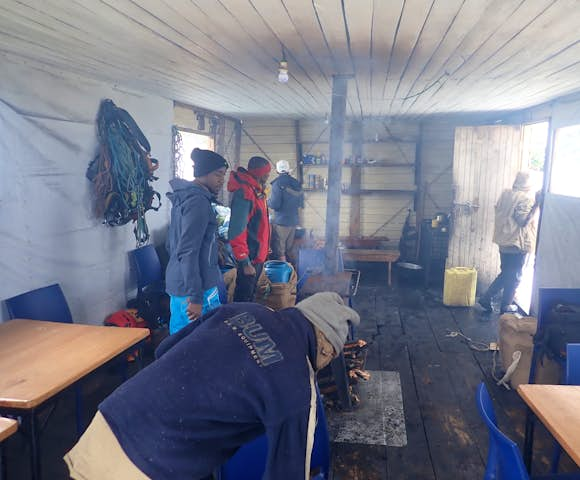
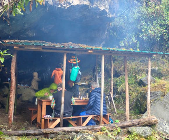
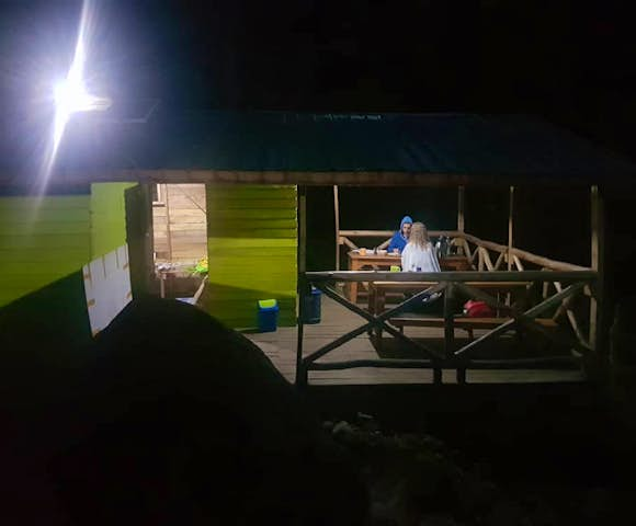
Accommodation on the treks is in specially constructed wooden huts, perfect for keeping out the worst of the weather and for storing equipment required on different sections of the trail. The treks are fully catered, using as much fresh produce as possible, whilst also meeting the energy and hydration needs of high altitude trekking.

Huts in the Rwenzori Mountains, Cheat Sheet
A quick fact sheet on the camps in the Rwenzoris. Each camp comprises shared wooden cabins with external toilets and showers.
-
Samilira Camp (3,170m)
- How many cabins are there? There are 3 cabins at Samilira Camp.
- How many beds in each cabin? 2 huts with 8 beds each. The 3rd hut has 3 beds.
- What are the room types? Bunk beds in the first 2 huts, singles in the 3rd hut.
- Are the toilets in a different hut, or self-contained? The toilets are outside the sleeping huts.
- What type of toilet does each hut have? Toilets are long-drop.
- What type of showers does each hut have? Bucket showers, but water can be heated.
- Which vegetation zone is the camp in? Montane Forest zone.
- What are the views like from the camp? From Samilira you can see parts of Kilembe and Queen Elizabeth National Park and Lake George. There are also great views of the surrounding mountains.
- Anything interesting in the area? There's a lovely small Lobelia garden right above the camp.
- Is there any electricity? There are no solar panels at Samilira, so there's no electricity here.
-
Kiharo Camp
- How many cabins are there? There are 4 cabins at Kiharo Camp.
- How many beds in each cabin? 3 huts with 8 beds each. The 4th hut has 1 double bed for couples.
- What are the room types? Bunk beds in the first 3 huts, double bed in the 4th hut.
- Are the toilets in a different hut, or self-contained? The toilets are outside the sleeping huts.
- What type of toilet does each hut have? Toilets are long-drop.
- What type of showers does each hut have? Bucket showers, but water can be heated.
- Which vegetation zone is the camp in? Heather zone.
- What are the views like from the camp? From Kiharo you can see parts of the Nyamwamba Valley and the Twin Peaks are right above the camp. There's a lot of birdlife around here (including the Rwenzori Turaco), and a beautiful waterfall 20 metres from the camp.
- Anything interesting in the area? There's a Lobelia garden on the approach, and a beautiful waterfall 20 metres away.
- Is there any electricity? There are solar panels at the camp with 240v inverters, so you can charge your phones and cameras here.
-
Mutinda Camp (3,588m)
- How many cabins are there? There are 3 cabins at Mutinda Camp.
- How many beds in each cabin? Each hut has 8 beds.
- What are the room types? Bunk beds.
- Are the toilets in a different hut, or self-contained? The toilets are outside the sleeping huts.
- What type of toilet does each hut have? Toilets are long-drop.
- What type of showers does each hut have? Bucket showers, but water can be heated.
- Which vegetation zone is the camp in? Combination of Heather and Afro-Alpine zones.
- What are the views like from the camp? From Mutinda, you have views of Mulyambuli valley and the Mutinda lookout above the camp. There are beautiful streams meandering through the valley and a couple of peaks are visible that have never been summited before!
- Anything interesting in the area? View from Mutinda lookout.
- Is there any electricity? There are no solar panels at Mutinda, so there's no electricity here.
-
Kalalama Camp (3,134m)
- How many cabins are there? There are 2 cabins at Kalalama Camp.
- How many beds in each cabin? One hut has 8 beds, the second hut has 3 beds.
- What are the room types? Bunk beds in the first cabin, 3 single beds in the second cabin.
- Are the toilets in a different hut, or self-contained? The toilets are outside the sleeping huts.
- What type of toilet does each hut have? Toilets are long-drop.
- What type of showers does each hut have? Bucket showers, but water can be heated.
- Which vegetation zone is the camp in? Heather zone.
- What are the views like from the camp? From Kalalama, you have views of Kilembe town and parts of Queen Elizabeth National Park, Lake Edward, and Lake George. You can also see some peaks like Rutamaguvu and Mutinda lookout.
- Anything interesting in the area? Large heather trees.
- Is there any electricity? There are solar panels here to charge phones and cameras.
-
Sine Hut (2,596m)
- How many cabins are there? There are 4 cabins at Sine Hut.
- How many beds in each cabin? 3 huts have 8 beds, the final hut has 10 beds.
- What are the room types? Bunk beds.
- Are the toilets in a different hut, or self-contained? The toilets are outside the sleeping huts.
- What type of toilet does each hut have? Toilets are long-drop.
- What type of showers does each hut have? Bucket showers, but water can be heated.
- Which vegetation zone is the camp in? Montane Forest Zone.
- What are the views like from the camp? Sine Hut is set under thick trees, so views are restricted. You can see traces of the meandering Mulyambuli river.
- Anything interesting in the area? Enock Falls.
- Is there any electricity? There are solar panels here for lighting.
-
Bugata Camp (4,062m)
- How many cabins are there? There are 2 cabins at Bugata Hut.
- How many beds in each cabin? 8 beds in each hut.
- What are the room types? Bunk beds.
- Are the toilets in a different hut, or self-contained? The toilets are outside the sleeping huts.
- What type of toilet does each hut have? Toilets are long-drop.
- What type of showers does each hut have? Bucket showers, but water can be heated.
- Which vegetation zone is the camp in? Afro Alpine.
- What are the views like from the camp? From Bugata you have different views of Nyamugasani valley and the glacial lakes. You can also see some peaks like Keki peak and Mount Luigi di Savoir.
- Anything interesting in the area? Bugata Lake.
- Is there any electricity? There are no solar panels at Samilira, so there's no electricity here.
-
Butawu Camp & Hunwick's camp (3,974m)
- How many cabins are there? There are 3 cabins at each camp.
- How many beds in each cabin? 2 of the huts have 8 beds, the 3rd hut has 4 beds.
- What are the room types? 2 huts are bunk beds, the 3rd hut has 4 singles.
- Are the toilets in a different hut, or self-contained? The toilets are outside the sleeping huts.
- What type of toilet does each hut have? Toilets are long-drop.
- What type of showers does each hut have? Bucket showers, but water can be heated.
- Which vegetation zone is the camp in? Afro-Alpine zone.
- What are the views like from the camp? There are nice views of the Butawu valley which connects to Kitandara. There are also views of Mount Luigi de Savoir and Mount Baker with its glacial peaks. On a clear day, you can view parts of Mount Speke. 5-10 minutes from the camp you can see some small town of the DRC.
- Anything interesting in the area? Nothing in the immediate area.
- Is there any electricity? There are solar panels at the camp with 240v inverters, so you can charge your phones and cameras here.
-
Margherita Camp (4,485m)
- How many cabins are there? There are 4 cabins at Margherita Camp.
- How many beds in each cabin? 1 of the huts has 8 beds, the other 3 have 4 beds.
- What are the room types? Bunk beds.
- Are the toilets in a different hut, or self-contained? The toilets are outside the sleeping huts.
- What type of toilet does each hut have? Toilets are long-drop.
- What type of showers does each hut have? Bucket showers, but water can be heated.
- Which vegetation zone is the camp in? Alpine zone.
- What are the views like from the camp? There are nice views down the Kitandara Valley, including the Kitandara lakes. You can see Weismman's peak, Elena peaks, and Mount Speke.
- Anything interesting in the area? Great views of the glaciers at Elena peaks, parts of Mount Speke and Margherita peak.
- Is there any electricity? There are solar panels at the camp with 240v inverters, so you can charge your phones and cameras here.
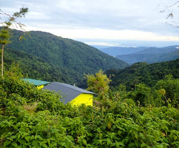
Views from Forest View Camp

When to Visit
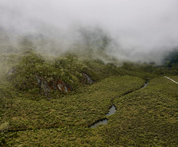
It is possible to trek in the Rwenzoris all year round. At all times of year you should be prepared for a combination of sun, rain, mud, fog, ice and snow. However, the period from late June to early September and again late December to the end of February does tend to have lower rainfall, which means visitor numbers do peak during this time.
It is also worth remembering that the wetter months mean more rain lower down the slopes, but more snow at higher altitude, enhancing the already mystical experience of trekking in the Rwenzoris.

Picture perfect day at the start of the trek
Geography & Geology
Born of tectonic plate movement about three million years ago when ancient gneissic, quartzite and other crystalline rocks were forced up from the base of the Albertine Rift, the Rwenzoris are a 120 kilometre long, 65 kilometre wide mountain range running along the border with the DRC north of Lake Edward.
Unlike free-standing volcanoes like Mounts Kilimanjaro and Kenya, the Rwenzoris are formed from uplifted rock squeezed by tectonic plate movement in the late Pliocene era. They are therefore the largest mountain range in Africa.
The Rwenzoris are comprised of six distinct mountains and despite being located just north of the equator, the three highest - Mount Stanley (5,109m), Mount Speke (4,890m) and Mount Baker (4,843m) all have permanent snow and glaciers.
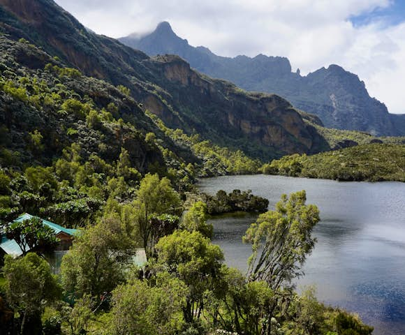
The mountains receive over 3 metres of rainfall a year. This sustains the snow and the mud-bound trails, but it also is responsible for over 20 lakes throughout the national park. In particular, in the Nyamwamba Valley, ascended by the Kilembe Trail, dams created by glacial moraine have created a string of eight truly beautiful lakes. Water also flows from the mountains in a network of rivers and streams, sustaining life across a vast area in the plains below.

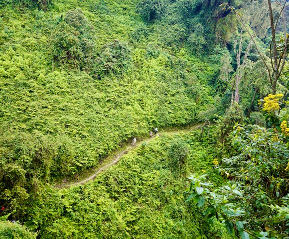
Rwenzori is where luscious greens transform to snow-capped peaks.
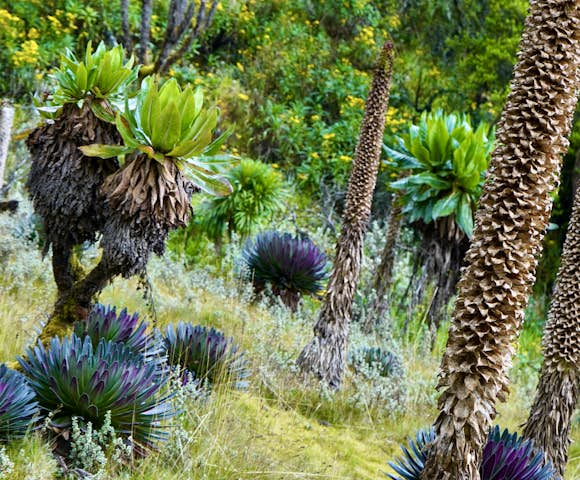
Flora & Fauna
Flora
Aside from the high alpine views, it is the flora of the mountains that has a far greater impact on the visitor than the local fauna.
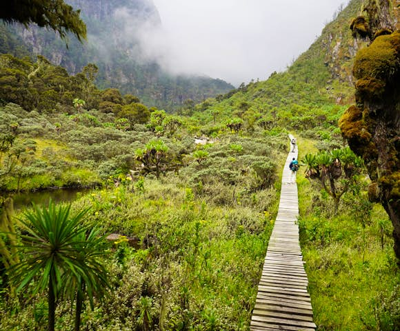
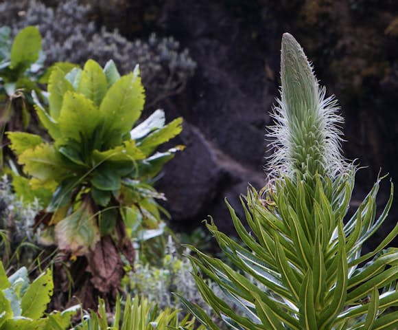
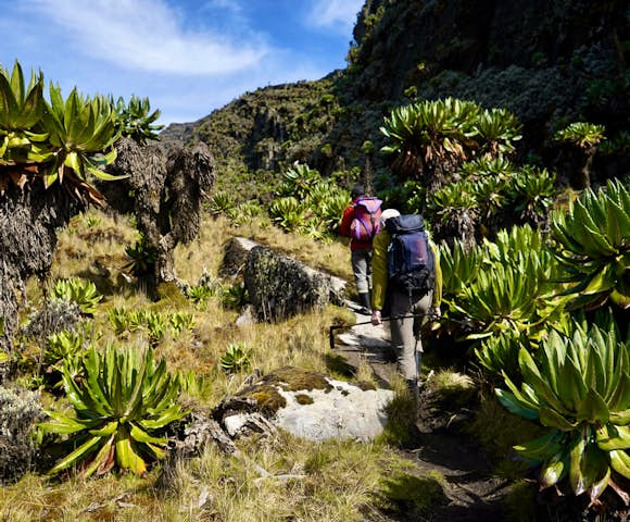
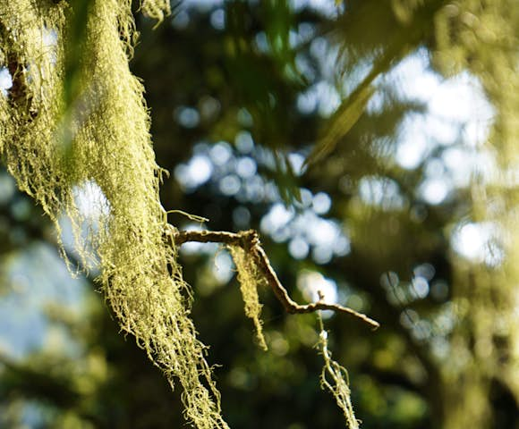
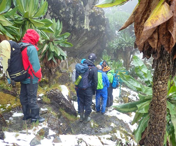
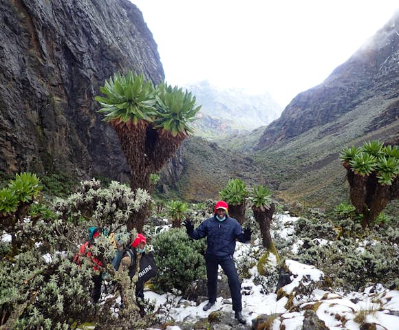
Water is everywhere: cloud-bound, heavy in the mist, filling mountain streams and making mirrors of lakes. Temperature below 4,000 metres rarely exceeds 15 degrees Celsius and stays above freezing. This means that life thrives and the plants are dramatic. The lobelia are massive; heather stretches across the valleys; while garishly-coloured moss creeps across gnarled trees draped with lichen.
A trek will take you through different altitudinal zones of vegetation, each with its own micro-climate, flora and fauna. There are 5 major vegetation belts in the Rwenzoris:
- Afro montane vegetation zone: 1765m - 2600m
- Bamboo zone: 2600m - 3000m
- Heather zone: 3000m - 3800m
- Moorland (Afro- Alpine zone): 3800m - 4500m
- Rocky glacier: 4500m+
The Afro-montane forest covers the slopes between 1,800m and 2,500m and has the most variety. Large established trees push to establish a canopy, whose breaks are filled by dense thickets. From 2,500m to 3,000m dense forest gives way to bamboo stands, leaves cover the ground in a dense litter and the flowers emerge only once every 30 years.
Above this, until 4,000m, you enter the heather zone. Sphagnum moss and usnea beard lichens pervade and the ground is stabbed with coral pink orchids. Bog-wet valley bottoms are populated by large tussocks.
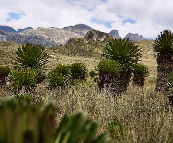
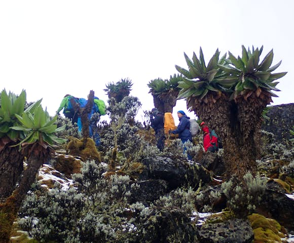
Above 4,000m the alpine zone hosts giant groundsel, Senecio adnivalis and the torch lobelia, Lobelia wollastonii. After 4,300m the vegetation begins to thin out until nothing grows except moss, lichen and a few ‘Everlasting’ plants. The plants found above 3,800m are members of some of the world’s rarest botanical communities.
You can learn more on our guide to Flora & Fauna in the Rwenzoris.
Fauna
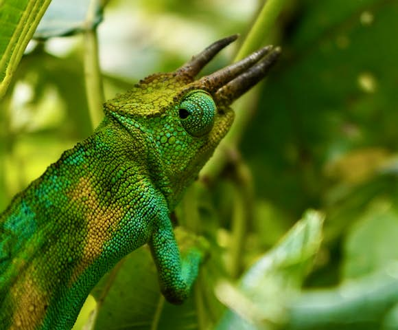
The vegetation zones are home to 70 species of mammal and 177 bird species. Of the mammals, there are elephants, chimpanzees, Rwenzori otters and leopards. Although present, the dense forest means these are seldom seen. Primates such as colobus (Angola and black-and-white varieties are both thought to be present) and blue monkeys are easier to spot, as are small antelope such as bushbucks and unusual reptiles such as the three-horned chameleon.
Of the bird species present, several are Albertine Rift endemics which makes the Rwenzoris an Important Birding Area (IBA). The greatest diversity is found in the montane forest where you may see the Rwenzori Turaco, Barred Long-tailed Cuckoo, Long-eared Owl, Handsome Francolin, Cinnamon-chested Bee-eater, Archers’ Robin-chat, White-starred Robin, Rwenzori Batis, Montane Sooty Boubou, Lagden’s Bush Shrike, Slender-billed Starling, Blue-headed Sunbird, Golden-winged Sunbird, Strange Weaver and several varieties of Barbets, Greenbuls, Apalises, IIladopsis, Flycatchers and Crimsonwings.
And don’t forget the superstars: up high hunt the lammergeiers and black eagles.

Getting to the Rwenzori Mountains
The nearest built-up area to the Rwenzori Mountains is the city of Kasese.
Kasese is easily accessible by air from Entebbe with daily flights taking just over an hour. Alternatively, the road journey from Entebbe/Kampala, via Fort Portal takes 6-8 hours.
You can also reach Kasese by flight from Etnebbe. The flights depart Entebbe at 7am and 12:30pm daily, and line up well with hike departures. The return flight leaves Kasese at 10:45am and 2:45pm daily. The flight time is about 1 hour.
It's also possble to reach the mountains by public bus from Kampala. The bus departs from Kamapala city centre every hour and costs approximately 50,000 UGX (~$14 USD). We recommend Link Bus or Kalita Transporters bus. From Kasese, you can hire a taxi to Kilembe for ~40,000 UGX. Total transfer time is around 10 hours.
If you book with us, all transfers can be arranged for you.
Treks in the Rwenzoris begin at Trekkers Hostel Kilembe (also known as Rwenzori Backpackers Hostel Kyanjuki). The treks begin with an 8:00am briefing from the guides. The hostel is 12km from Kasese (30-40 minutes by road).
If coming up from Queen Elizabeth National Park, the journey takes about an hour. Bwindi Impenetrable National Park in the south-west corner of Uganda (home to the mountain gorillas) is about a six-hour drive.

Into the Alpine zone at 4,000+ metres
Popular Treks in the Rwenzori Mountains
The tours below showcase just some of what is possible. Use these itineraries as starting points, or to draw inspiration. Then get in touch, and let our expert team help craft the perfect itinerary for you.
Discover More of Uganda


How Can We Help You?
We love helping people plan adventures to Uganda, and with a network of local partners and years of experience, we can help you decide when to travel, where to go and what to see.
Get to know us
What our customers say

Ready to explore Uganda?
Listen
We'll spend some time listening to your aspirations, then discuss the kind of experience that might suit you.
Match
Next we'll discuss the options, shortlist the best trips for you and present you our impartial recommendations.
Reserve
We'll place a 24 hour hold on your preferred option - without obligation - whilst we talk through the details.
Whatever your budget, group size, length of stay, preferred activity or appetite for adventure, we can help.
+1 315 645 2889